Definition
GNSS (Global Navigation Satellite System) is a generic word covering all satellite based navigation systems. The first constellation launched was GPS (Global Positioning System), followed by Russian GLONASS, and more recently Chinese BEIDOU and European GALILEO. Some other local constellation can complement or replace the system such as QZSS in Japan, or IRNSS over India.
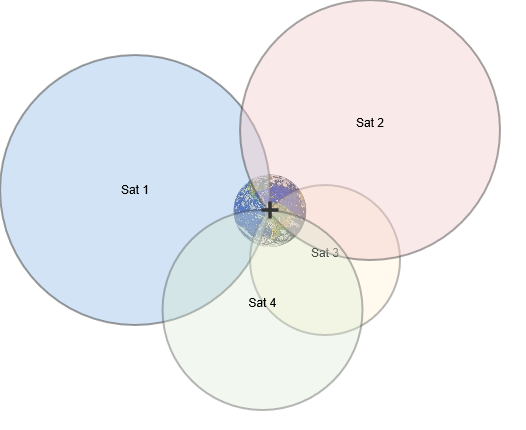
The major principle used in GNSS is the triangulation : A GNSS receiver is able to measure its distance with respect to all satellites in view.
Using at least 4 satellites measurement, and knowing the satellites position, the receiver is then able to accurately compute its own position.

Ground segment
In order to get precise satellites position, a "Ground Segment", composed of many ground control stations located all over the world, compute the satellites position and transfer it back to the satellites.
Standalone GNSS accuracy
The accuracy of a standalone GNSS position ranges form 3 to 10m.
Satellite based Augmentation systems
In order to reduce the total error budget and increase integrity of the GNSS navigation, some augmentation systems have been developed. The main one is SBAS (satellite based augmentation system), which have several implementations WAAS, EGNOS, MSAS, GAGAN, and some other are in development.
SBAS accuracy now reaches typically a sub meter level.
Ground based Augmentation Systems / DGPS
The Ground based Augmentation systems uses differential corrections (DGPS or DGNSS) to improve the performance of a receiver in a local area. It assumes that the major part of the position error budget comes from atmospheric errors, and can be canceled by using differential computations.
DGPS accuracy typically reaches a sub meter level.
Real Time Kinematic (RTK)
RTK is an extension of DGPS using phase and code measurements to achieve centimeter level accuracy.
RTK also takes a great benefit of multi constellations and muti band tracking to increase centimeter level availability.
GNSS as INS aiding
A GNSS receiver is used as the source of position, velocity and time, but can also be a source of True heading if using a dual antenna GNSS receiver. These outputs can be in different formats. It will be either ASCII with the standard NMEA format, or Binary with the format depending on the brand of the GNSS receiver that is being used. RTK GNSS receivers can be used to deliver centimeter positioning accuracy.
In SBG Systems product variants, all models N and D embed a GNSS receiver. A second external receiver can also be connected to the high performance series if required. Other INS products accept one or two external GNSS data inputs to enhance navigation performance.